Bergen, Norway: Fjords Near the City and the Best Scenic Ascents

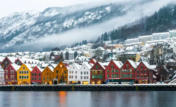
Bergen stands on Norway’s western coast where mountains meet the North Sea and deep fjords cut into the land. Because of this geography, travellers can move from historic streets to dramatic landscapes within minutes. The city itself grew as a trading port during the Hanseatic era, yet its surroundings remain defined by nature: steep hills, narrow waterways, and viewpoints that reveal the scale of the Norwegian coastline. Bergen is often called the gateway to the fjords, but it is also a place where visitors can reach panoramic summits without travelling far from the centre. Cable cars, funicular railways, hiking paths and nearby ferry routes all make it possible to combine urban exploration with wide views of fjords, islands and mountains.
Fjords Accessible from Bergen
Bergen lies close to several of Norway’s most famous fjord systems. The nearest large waterway is the Hardangerfjord, located roughly two hours from the city by car or organised excursion. Stretching more than 170 kilometres inland, it is the second-longest fjord in Norway and known for steep cliffs, fruit orchards along its shores, and waterfalls descending from mountain plateaus. Many travellers visit villages such as Norheimsund or Eidfjord to experience the scale of this landscape.
Another major destination is Sognefjord, often described as the longest and deepest fjord in Norway. From Bergen, trains or boats connect travellers to this region through the famous “Norway in a Nutshell” travel route. Branches of Sognefjord such as Nærøyfjord are recognised as UNESCO World Heritage landscapes because of their narrow shape and high rock walls that rise dramatically above the water.
Closer to Bergen itself lies Osterfjord, a narrower fjord that can be explored on half-day boat cruises from the city harbour. Because of its proximity, it is often the first fjord experience for visitors staying in Bergen. The surrounding mountains create sheltered waters where small settlements and farms remain visible along the shoreline, providing a sense of traditional coastal life.
How to Reach the Fjords from the City
Bergen’s harbour has been a departure point for coastal travel for centuries, and modern transport still follows these maritime routes. Several ferry companies operate fjord cruises directly from Bryggen and the central port area. These vessels travel through nearby fjords and narrow channels between islands, allowing passengers to observe steep rock faces and waterfalls without leaving the region.
Rail connections also make fjord exploration possible in a single day. The Bergen Railway links the city with the mountain station at Myrdal, where travellers can transfer to the Flåm Railway. This historic line descends through steep valleys to the village of Flåm on the shores of Aurlandsfjord, one of the branches of Sognefjord.
For travellers who prefer flexible schedules, road travel offers access to multiple fjord viewpoints and small villages. Scenic routes lead east toward Hardangerfjord and north toward Sognefjord, passing waterfalls, mountain passes and traditional wooden houses along the way.
Mount Fløyen and the Funicular Viewpoint
One of the most recognisable viewpoints in Bergen is Mount Fløyen, rising roughly 320 metres above the harbour. The Fløibanen funicular railway, operating since 1918, carries passengers from the city centre to the summit in about six minutes. From the upper station, visitors see the harbour, the old Bryggen district and the surrounding islands scattered across the North Sea.
Mount Fløyen is not only a viewing terrace but also the beginning of a wide network of walking trails. Paths lead through forests, lakes and small mountain plateaus where locals often go hiking or jogging. Even short walks from the top station reveal quiet natural areas despite their closeness to the city centre.
During clear weather the summit offers views far beyond Bergen itself. The horizon includes parts of the surrounding fjord system and the chain of mountains known locally as the “Seven Mountains” that frame the city. Because of its accessibility, Fløyen remains one of the most visited natural sites in western Norway.
Walking Routes and Nature Around Fløyen
The area around Mount Fløyen contains well-maintained trails suitable for both casual walkers and experienced hikers. One of the most popular routes leads toward Mount Ulriken, forming a ridge walk between two of Bergen’s highest peaks. This journey takes several hours and reveals multiple perspectives of fjords and valleys.
Families often explore the lake area near Skomakerdiket, located a short distance from the funicular station. Here the landscape becomes quieter, with forest paths and picnic areas overlooking calm mountain water. It demonstrates how quickly Bergen’s surroundings shift from urban streets to natural terrain.
In winter the Fløyen plateau occasionally receives enough snow for cross-country skiing, a reminder that the region remains connected to Norwegian outdoor traditions. Even when weather conditions change rapidly, the trails remain accessible thanks to marked routes and information boards placed along the paths.
Mount Ulriken and Bergen’s Highest Panorama
Mount Ulriken rises to approximately 643 metres and forms the highest point among the mountains surrounding Bergen. Unlike Fløyen, which focuses on forested terrain, Ulriken offers more open alpine scenery. From the summit, visitors gain a broader view of fjords, mountain ridges and the city spread along the coastline.
The Ulriken cable car provides the most direct route to the top. Modern cabins transport passengers from the base station to the summit in just a few minutes. The upper area includes observation terraces and a café where travellers often pause to watch changing weather patterns across the fjord landscape.
Ulriken also marks the starting point of the well-known Vidden hiking route, which runs across mountain terrain toward Mount Fløyen. This path is considered one of the most rewarding hikes near Bergen because it combines high plateaus with distant views of the sea and surrounding islands.
The Vidden Ridge and Extended Mountain Views
The Vidden trail stretches roughly 13 kilometres between Ulriken and Fløyen. Along the route hikers move through rocky plateaus, small lakes and open mountain ground that contrasts with the forested slopes closer to the city. Because the path remains elevated for much of the journey, the horizon constantly reveals fjords and distant peaks.
Weather conditions can change quickly in these mountains, even during summer months. Local authorities therefore recommend checking forecasts and wearing suitable hiking equipment before starting the walk. Despite this, the route remains accessible to many travellers who prepare properly.
Reaching the opposite end of the ridge near Mount Fløyen provides a gradual return to Bergen’s urban landscape. The path descends through woodland before arriving back at the funicular station, completing a route that connects two of the most famous viewpoints in western Norway.